Our paper, Monitoring Maize Yield Variability over Space and Time with Unsupervised Satellite Imagery Features, is now out in Remote Sensing. It started as our MEDS capstone project and grew into a full paper with Juliet Cohen, Grace Lewin, Steven Cognac, Protensia Hadunka, Jonathan Proctor, and Tamma Carleton.
The question
Zambia is prone to severe droughts and crop failures, but ground data on yields is limited. During COVID-19, for example, district-level maize surveys stopped entirely. Methods like MOSAIKS make it cheap to turn satellite imagery into features for prediction. Until now, though, nobody had tested whether these simple pipelines can track change over time in a low-data, developing-country setting. Most evaluations only look at variation across space.
What we did
We computed random convolutional features from Landsat and Sentinel-2 imagery and paired them with district-level yield data. We then fit plain linear ridge regression models. There is no deep learning and no task-specific architecture.
What we found
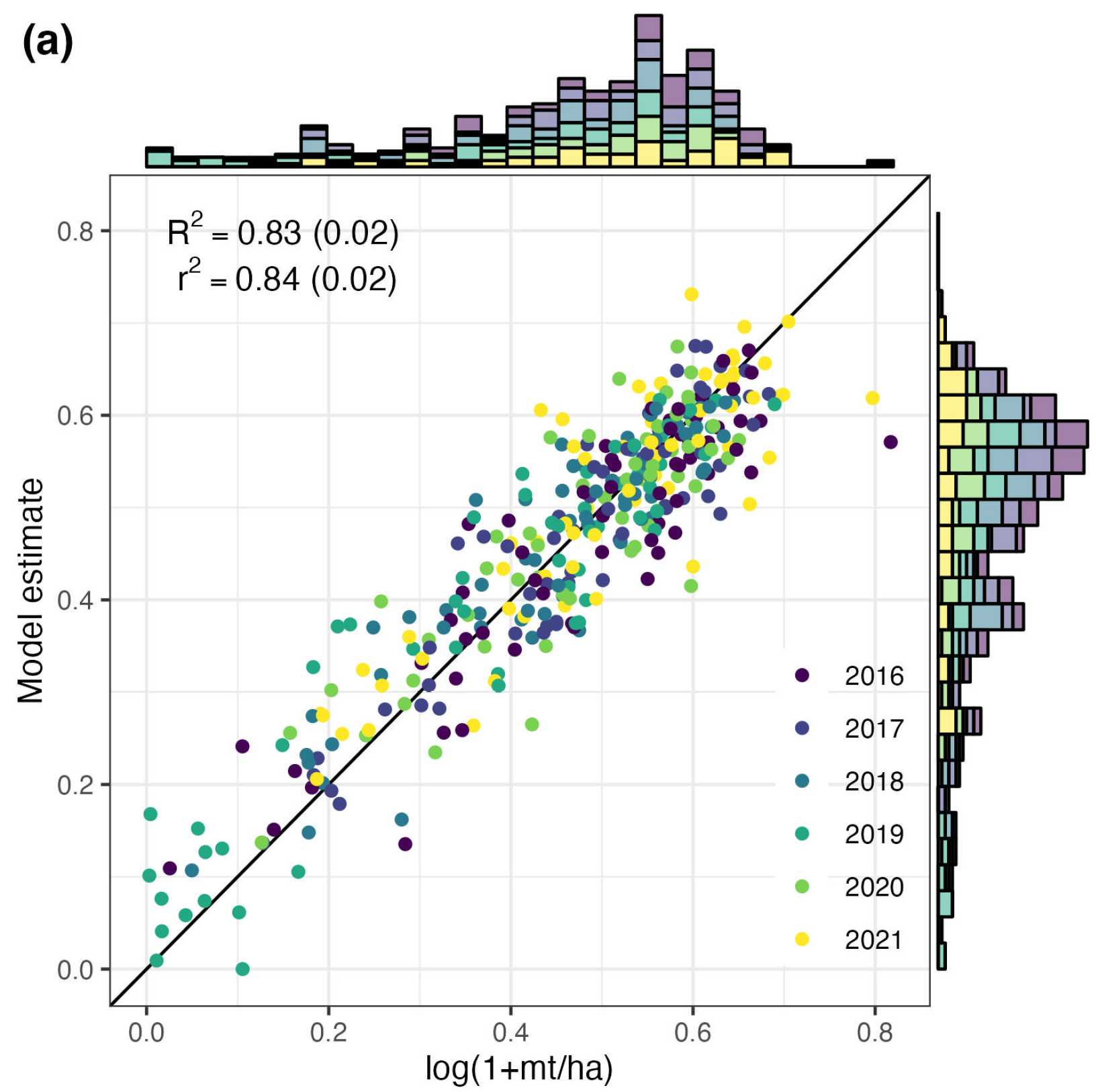
- The model explains 83% of out-of-sample maize yield variation from 2016 to 2021. That is slightly better than a model built on NDVI features, the standard approach practitioners use to monitor crop health.
- The real difference shows up over time. When predicting year-to-year variation alone, our model keeps an R² of 0.74, while the NDVI model drops to 0.39.
Why it matters
Monitoring droughts and food security depends on catching change from year to year. Our results show that task-agnostic featurization can capture that change even where ground truth is sparse and compute is limited. Imagery-based monitoring can work in exactly the places where expensive approaches are out of reach.
Citation: Molitor, C., Cohen, J., Lewin, G., Cognac, S., Hadunka, P., Proctor, J., Carleton, T. (2025). Monitoring Maize Yield Variability over Space and Time with Unsupervised Satellite Imagery Features. Remote Sensing, 17(21), 3641. doi:10.3390/rs17213641